Skip to quicklinks
Family admiring the sunset at a mountain cross
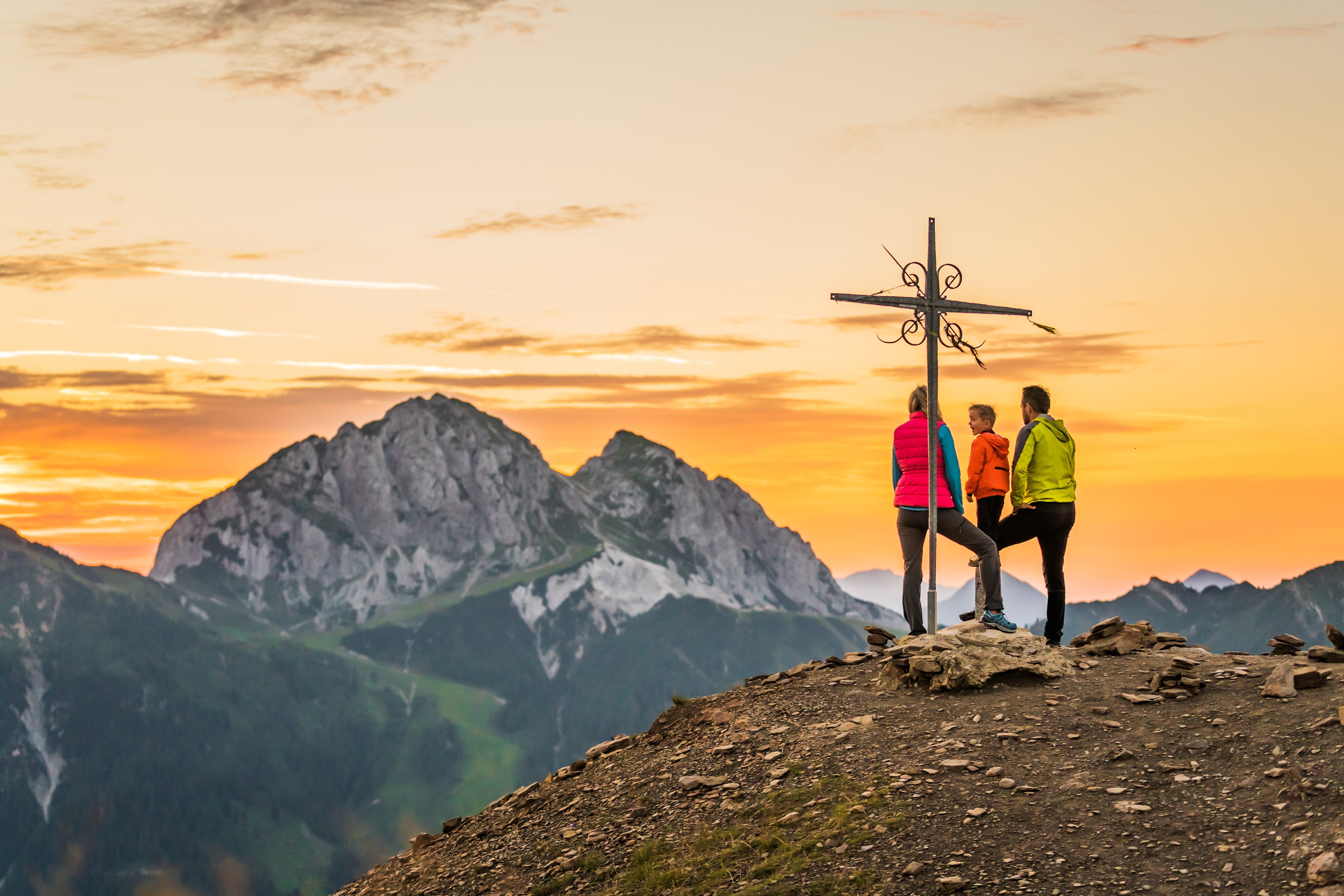
Family enjoying the sunset at a mountain cross
Insider tips for our guests

Hiking recommendations at Hotel Gartnerkofel

Here you will find numerous hiking trails.

Gartnerkofel

Gartnerkofel hike

The Gartnerkofel is one of the three distinctive mountain peaks at the Kärnten Nassfeld and a beautiful hiking tour for the whole family. Starting from the mountain station of the Gartnerkofel chairlift, the Gartnerkofel hike is an easy summit tour. The ascent follows a pleasant, consistent gradient, partly over the slopes of the ski area. The last section to the summit cross requires a bit of fitness and a head for heights. However, there are no truly exposed sections along the entire route.

  • Duration: 45 min
  • Distance: 0.8 km
  • Elevation gain: 292 m
  • Starting point: Gartnerkofel Cable Car

Tour from the hotel

The tour starts right at the Hotel Gartnerkofel. You follow the path from the hotel towards the state border, passing the Nassfeldkirchlein until you reach the Watschiger Alm. The ascent takes place at a pleasant, steady incline, partly over the slopes of the ski area. The last stretch to the summit cross requires a bit of stamina and a head for heights. However, there are no truly exposed spots along the entire route.

  • Duration: 2.5 hours
  • Length: 5.87 km
  • Elevation: 648 m
  • Starting point: Hotel Gartnerkofel

Gartnerkofel hike

The Gartnerkofel is one of the three distinctive mountain peaks at the Kärnten Nassfeld and a beautiful hiking tour for the whole family. Starting from the mountain station of the Gartnerkofel chairlift, the Gartnerkofel hike is an easy summit tour. The ascent follows a pleasant, consistent gradient, partly over the slopes of the ski area. The last section to the summit cross requires a bit of fitness and a head for heights. However, there are no truly exposed sections along the entire route.

  • Duration: 45 min
  • Distance: 0.8 km
  • Elevation gain: 292 m
  • Starting point: Gartnerkofel Cable Car

Kammleiten

You start your tour with a ride on the "Piccolo Express" to the Gartnerkofel cable car. From there, you take the cable car up to the mountain station. Continue heading north along the FIS downhill slope. At the mountain station of the FIS cable car, continue slightly left on the marked hiking trail. Follow the hiking trail to the Kühweger-Thörl and further to the summit cross.

Alternatively, you can also start directly from the hotel on foot and ascend via the Watschiger Alm to the Kammleitn.

  • Duration: 2 hours
  • Distance: 4 km
  • Elevation gain: 396 m
  • Starting point: Hotel Gartnerkofel

Rosskofel

The Rosskofel (2,240 m), also known as Monte Cavallo di Pontebba, is located in the western part of the Nassfeld ski area and is a karst mountain with many geological features. Its interior is traversed by cave systems, and several trails lead to the impressive summit plateau.

The path leads over ski slopes to the Rudnigsattel, where it connects with the Karnische Höhenweg 403, and old wartime positions can still be seen there. The trail goes through block and rocky terrain beneath the impressive rock face to the flat summit. Several variants lead up the mountain, which also hosts numerous alpine climbing routes.

  • Duration: 4 hours
  • Length: 5.4 km
  • Elevation gain: 650 m
  • Starting point: Rudnigalm or Madritschenbahn mountain station

Auernig

The starting point is right at the state border at the Nassfeld Pass (Passo Pramollo). Parking facilities can be found directly on site. It is also accessible from the lift via the beginner's platter lifts at Nassfeld/Madritschenbahn. An easy entry is right at the Plattnerweg towards Gartnerkofel, passing by the beautiful and historic border chapel (in memory of World War I). After about 1 km, at the first and only intersection, go right and head up the path towards Gartnerkofel. After the forest area under the saddle between Garnitzenberg and Auernig, leave the path and ascend through the gently undulating terrain towards Auernig. Stay on the ridge in the saddle area and pass by the pre-summit towards Auernig on the southern side of the mountain. Upon reaching the summit, Auernig surprises with a bell instead of a summit cross. The tradition says that ringing the bell at the summit fulfills a heartfelt wish!

  • Duration: 1.5 hours
  • Length: 2.76 km
  • Elevation gain: 333 m
  • Starting point: Hotel Gartnerkofel or state border

Trogkofel

The Trogkofel – which your Italian friends refer to as “Creta di Aip” in their hiking maps – can be ascended from various sides and in all possible levels of difficulty. Depending on your mood and personal judgment. This tour suggestion offers one of the slightly easier options for reaching the summit via the well-established route over the “Uiberlacher Steig”.

However, you should thoroughly check your personal prerequisites and skills for climbing the Trogkofel before you set off. This mountain is certainly not a playground for the inexperienced:

You should be absolutely sure-footed and experienced in rocky terrain, entirely free of vertigo, possess sufficient stamina, and be appropriately equipped. Very good mountain weather should also be part of the equation, as the Trogkofel often presents itself shrouded in clouds and fog. Such impaired visibility, especially on the highly karstified summit plateau during your descent, does not exactly contribute to optimal orientation.

And given that any motivation that may still be needed usually kicks in during the course of the tour, nothing stands in the way of your ascent to the Trogkofel.

  • Duration: 5.0 hours
  • Distance: 8.12 km
  • Elevation gain: 770 m
  • Starting point: Rudnigalm

Winkelalm

From the Nassfeld Pass, we hike on the Promenade Trail west of Lake Nassfeld towards the south. A short stretch to the left on the dam, then we follow the sign for "Winkelalm" through wetlands and mountain slide forests – very romantic, crossing small streams, direction SW. After reaching the forest road just behind the former barracks, we ascend slightly to the right, passing notable rocks, and reach Winkelalm, which is situated in a clearing. From here, we could ascend to Malurch or head towards Winkelscharte to climb Rosskofel via the via ferrata. It is also possible to hike towards Austria and Madritsche, with some quite steep sections. However, we will walk back today on the path 433 towards the former barracks and from there along Nassfeldstraße to the starting point.

  • Duration: 1 hour
  • Distance: 4.2 km
  • Elevation gain: 110 m
  • Starting point: Hotel Gartnerkofel

Aqua Trail "Bergwasser" & Dolce Vita trail

Play and marvel along the stroller-friendly adventure trail that brings nature closer to young and old with every step! Over a length of 1.5 km, you will experience not only the fascinating mountain world but also a lake and numerous adventure stations. You will learn about the element of water in a playful way, engage in dam building, or examine a real sailboat at an altitude of 1,900 meters.

The “Via Dolce Vita” is an extension of the Aqua Trail, a true means of transport with panoramic views to explore the distance and – wonder of wonders – Italian Vespas as a photo opportunity. A playground that looks like a former customs station and offers endless swing fun.

  • Duration: 2.5 hours
  • Length: 2.5 km
  • Starting point: Hotel Gartnerkofel Mountain Station Millenium Express/Mountain Station Madritschen Chairlift

Kühweger Alm

The Kühweger Alm, at 1,480 m, is a small, cozy alpine pasture located at the northern foot of the Gartnerkofel in the eastern Carnic Alps. A beautiful hike leads from the Watschiger Alm over the Kühweger Pass, 1,914 m, to the pasture.

  • Duration: 2 hours
  • Distance: 3.7 km
  • Elevation gain: 430 m
  • Starting point: Hotel Gartnerkofel or Watschiger Alm

Madritschen Tour

The stone people of Madritschen need your help! On the Madritschen Tour, you will experience an adventurous hike in the Carinthian mountains. You will need to solve tricky challenges, be creative, and show your skills. At the end of the trail, a mighty stone awaits, which, with the right twist, will free the ancient stone people.

  • Duration: approx. 4.5 hours
  • Length: 11.7 km
  • Elevation gain: 714 m
  • Starting point: Valley station of Madritschen chairlift

Lake loop at Lake Pressegger

From the Hermagor beach resort or the Pressegger beach resort, you will embark on this popular family hike around Lake Pressegger.

  • Duration: 1.4 hours
  • Distance: 5.88 km
  • Elevation gain: 650 m
  • Starting point: Oswald beach resort

From the Hotel Gartnerkofel, the paved path leads you directly to the Treßdorfer Alm. (Exit the hotel and turn right - towards the west)

Alternatively, you can reach the Treßdorfer Alm by the "Piccolo Express" – you can find the departure times at the reception or in the Gartnerkofel app.

  • Duration: 25 min
  • Distance: 1 km
  • Elevation gain: 300 m
  • Starting point: Hotel Gartnerkofel

From the Hotel Gartnerkofel, the path leads you (exit the hotel entrance to the left - heading east) to the main road - turn right and continue towards the state border. Just before the state border, turn left - along the asphalted road uphill. Now, follow the road for about 1.5 km until you reach the Watschiger Alm.

  • Duration: 40 min
  • Distance: 3 km
  • Elevation gain: 250 m
  • Starting point: Hotel Gartnerkofel

From the Hotel Gartnerkofel, the path (leading out to the left at the hotel entrance - towards the east) continues to the valley station of the "Madritschen" cable car. Right at the valley station of the cable car, you will also find the playground "In the Realm of the Wild Gang."

  • Duration: 10 min
  • Distance: 250 m
  • Starting point: Hotel Gartnerkofel

Variant A

From the Hotel Gartnerkofel, the path leads you (out of the hotel entrance, turn left - heading east) to the main road - turn right and continue toward the state border. Just before the state border, turn left - following the paved road uphill. Now follow the road for about 1.5 km until you reach a branch to the right - from there, continue on a forest road. Follow this forest road. On your way up, you'll also pass one of the power spots of the Nassfeld: "Power Spot Stone Circle."

Continue along the route until you reach the next fork in the path at the top of the ridge. Now go a little further uphill until you reach the mountain playground "Almrausch."

Variant B: (Faster option)

You start your tour with a ride on the "Piccolo Express" to the Gartnerkofel cable car. Take the cable car up to the mountain station. Once you arrive at the top, you'll find the mountain playground "Almrausch" right there.

  • Duration: 1.5 hours Variant A / 30 minutes Variant B
  • Distance: 4.5 km
  • Elevation: approx. 400 m Variant A
  • Starting point: Hotel Gartnerkofel

From the Hotel Gartnerkofel, the paved path leads you directly to the Treßdorfer Alm. (Exit the hotel and turn right - towards the west)

Alternatively, you can reach the Treßdorfer Alm by the "Piccolo Express" – you can find the departure times at the reception or in the Gartnerkofel app.

  • Duration: 25 min
  • Distance: 1 km
  • Elevation gain: 300 m
  • Starting point: Hotel Gartnerkofel